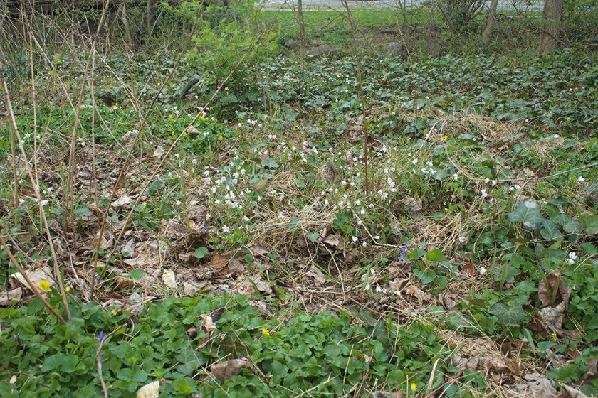
This is part 2 of my series on riparian areas near my garden. Not sure if I’ll get to part 3 so maybe this will be a combination. Oh yeah, and all photos were taken this spring.

My garden sits between two tributaries of the Chesapeake Bay. One is Rock Creek about a mile to the west that runs into the Potomac River. The other is Sligo Creek, a half mile to the east that runs into the Anacostia River and then the Potomac. Both creeks cut through ancient bedrock forming the Fall Line between the Piedmont Plateau and the unconsolidated sediments of the Coastal Plain.
Quite a few million years ago, continents collided to form mountains now known as the Appalachians. They were as tall as the Himalayas and volcanoes scattered a mix of ash and rock all over the landscape. All this heat, pressure and volcanic churning crushed sedimentary rock transforming it into a hard bedrock of acidic rock inundated with fragments of more basic volcanic rock. Gradually, rain and wind wore away at the mountains breaking the rock back into sediment and distributing it into the valleys and along the streams creating niches of rich, loamy soil and steep slopes with thin, acidic soils. A greater diversity of plants grew in the rich soils but some plants found a way to thrive in the poorest soils.


Little is known about the original people that lived and traveled around Sligo and Rock Creek. It is said that ancient tribes made hundreds of thousands of stone tools from the rocky bluffs along Rock Creek where to this day the ground is still covered with the cobble fragments of their industry.
Archaeologists discovered three spearpoints and a piece of pottery in the rootball of a fallen tree near the mouth of Rock Creek which lead to further findings of spearpoints, knives, potsherds and other artifacts dating from 2500 BC to AD 1500. But it turned out not to be a village but a seasonal camp. They were a nomadic people who often burned the forest to make open areas for travel, camps, agriculture and hunting. Trees such as chestnut oak probably dominated due to their ability to withstand fire.
When the Europeans arrived thousands of years later, the waters were rich with sturgeon, beaver and duck and the forests and prairies with deer, bison and bear. The Nacotchtank (also known as the Anacostain) was a tribe that lived in a village just east of the Anacostia River where they traded furs with other tribes as well as the Europeans.
Rock Creek has changed dramatically over the years. In the 16 and 1700’s, slaves farmed tobacco until the soil around Rock Creek was so exhausted landowners had to switch to other forms of farming such as wheat and corn. Gristmills were built to make flour.
Much of the forest along Rock Creek was cleared during the Civil War which is why many of the older trees have divided trunks. Then in 1890, Rock Creek was established as a national park and it must have looked sparse with such a young recovering forest. Much of the forest has recovered especially areas that hadn’t been cleared, but many areas that were heavily disturbed are still recovering with characteristics of semi-natural communities indicative of early forest succession.

Sligo creek was presumably named for what is now the intersection of Georgia Ave and Colesville. Apparently the Irish who came to work on the C&O Canal called it Sligo after a county in Ireland. Colesville road crosses the creek a half a mile from the intersection.

Less than 15% of the Sligo subwatershed is undeveloped and only 10% is forested. It is also one of the most urbanized subwatersheds in the Anacostia watershed which is why it’s not too surprising that a lot of the vegetation is non native and I’m guessing a large part of that is considered invasive. Deer eat many of the native plants and tree seedlings before they can get established. But somehow native remnants remain. Some such as trout lily and spring beauty seem choked by invasives while others such as spicebush and tulip poplar thrive.


A mix of run away garden plants, remnant natural communities and transient sediment swirl together along the creek. I suppose the technical name for these communities is semi-natural or I’ve even heard them described as novel ecosystems. Whatever the name, I can say I’ve never heard or seen a frog, toad or snake but I’ve seen a large tadpole in a vernal puddle and a turtle once on a bank. I’ve seen a few fish in the creek and some wood ducks and a blue heron and once heard a barred owl at dusk. I could just make out the shadow of its large body as it flew over my head.
I heard an interview with Jason Anderson, an ancestor of the Nacotchtank tribe, who said this,
“Hear history through the wind down at the river on the grasses. That’s the map we need to find so we can navigate the change.”
I’m not at all sure what that means but for some reason it keeps going through my head. And so I go down to the river. Or the closest thing, the creek.
Sources:
History of Land and Water Use of Rock Creek
Wikipedia History of Sligo Creek
Interview with Jason Anderson, Ancestor of Nacotchtank
National Park Service article about Native Americans in Rock Creek Park:
Click to access ROCR%20Ancient%20Native%20Americans%20in%20Rock%20Creek%20Park.pdf

